


WESTERN MOUND Voting District, Macoupin County, Illinois
About
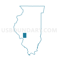
Outline

Summary
| Unique Area Identifier | 573166 |
| Name | WESTERN MOUND Voting District |
| County | Macoupin County |
| State | Illinois |
| Area (square miles) | 35.12 |
| Land Area (square miles) | 35.00 |
| Water Area (square miles) | 0.12 |
| % of Land Area | 99.65 |
| % of Water Area | 0.35 |
| Latitude of the Internal Point | 39.30649340 |
| Longtitude of the Internal Point | -90.08962880 |
Maps


Graphs
Select a template below for downloading or customizing gragh for WESTERN MOUND Voting District, Macoupin County, Illinois


Neighbors
Neighoring Voting District (by Name) Neighboring Voting District on the Map
- BARR 1 Voting District, Macoupin County, IL
- BIRD Voting District, Macoupin County, IL
- CHESTERFIELD 1 Voting District, Macoupin County, IL
- POLK Voting District, Macoupin County, IL
- ROCKBRIDGE I Voting District, Greene County, IL
- ROCKBRIDGE III Voting District, Greene County, IL
- RUYLE Voting District, Jersey County, IL
Top 10 Neighboring County Subdivision (by Population) Neighboring County Subdivision on the Map
- Rockbridge township, Greene County, IL (1,633)
- Chesterfield township, Macoupin County, IL (855)
- Polk township, Macoupin County, IL (563)
- Ruyle township, Jersey County, IL (421)
- Barr township, Macoupin County, IL (329)
- Bird township, Macoupin County, IL (308)
- Western Mound township, Macoupin County, IL (272)
Top 10 Neighboring Place (by Population) Neighboring Place on the Map
Top 10 Neighboring Unified School District (by Population) Neighboring Unified School District on the Map
- Southwestern Community Unit School District 9, IL (9,504)
- Carlinville Community Unit School District 1, IL (9,460)
- Greenfield Community Unit School District 10, IL (2,759)
- Northwestern Community Unit School District 2, IL (2,340)
Top 10 Neighboring State Legislative District Lower Chamber (by Population) Neighboring State Legislative District Lower Chamber on the Map
Top 10 Neighboring State Legislative District Upper Chamber (by Population) Neighboring State Legislative District Upper Chamber on the Map
Top 10 Neighboring 111th Congressional District (by Population) Neighboring 111th Congressional District on the Map
Top 10 Neighboring Census Tract (by Population) Neighboring Census Tract on the Map
- Census Tract 101, Jersey County, IL (5,150)
- Census Tract 9736, Greene County, IL (3,812)
- Census Tract 9565, Macoupin County, IL (2,652)
- Census Tract 9562, Macoupin County, IL (2,519)
Top 10 Neighboring 5-Digit ZIP Code Tabulation Area (by Population) Neighboring 5-Digit ZIP Code Tabulation Area on the Map
- 62626, IL (8,354)
- 62044, IL (2,009)
- 62063, IL (1,214)
- 62630, IL (532)
- 62649, IL (488)
- 62081, IL (298)